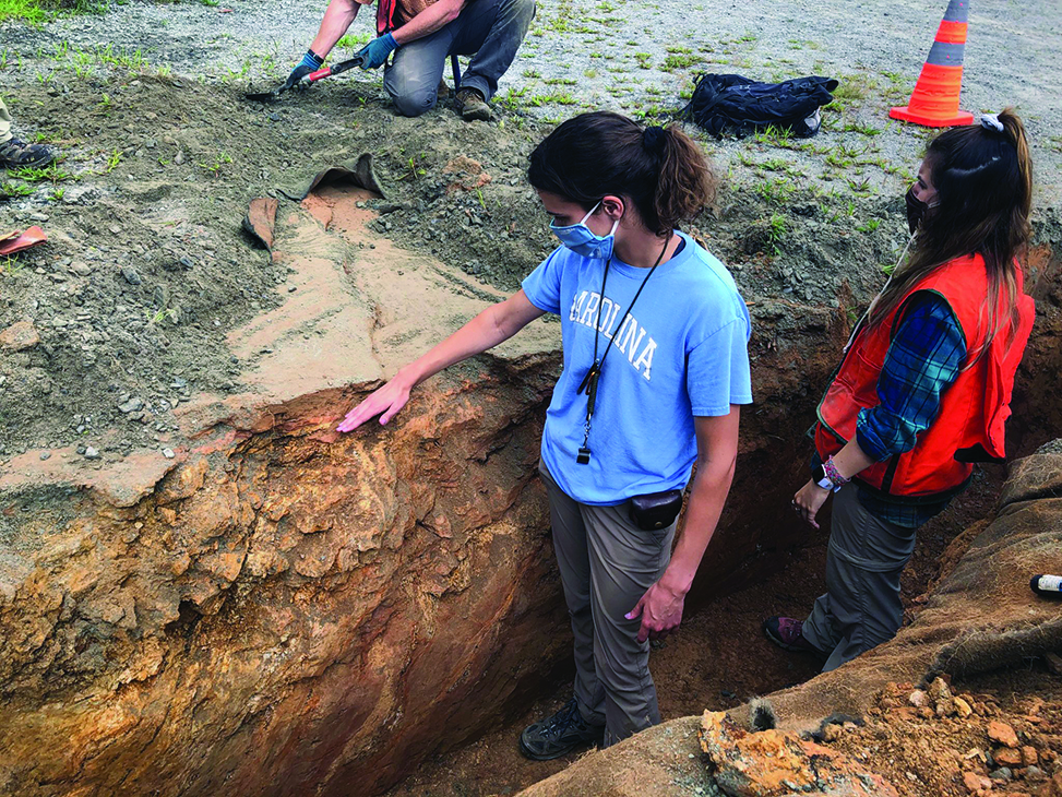
Graduate student Sarah Wells-Hull, left, puts her hand on the Little River fault after an earthquake in Sparta, North Carolina.
Think of earthquakes, and images of cracked highways showing obvious fault lines come to mind. In the eastern U.S., those kinds of sights had not occurred until a 5.1 magnitude quake in Sparta, North Carolina, on Aug. 9, 2020, became the first to reveal a fault line.
On that morning, Carolina geologist Kevin Stewart rushed to Sparta. Stewart is a professor in the earth, marine and environmental sciences department. His specialty is researching structural geology such as faults and cracks in the Earth’s crust.
The Sparta earthquake was felt by people across North Carolina, much of the Eastern U.S. and west into Tennessee and Kentucky. Stewart was on site in the small town by noon, along with colleagues from the U.S. Geological Survey and NC State. One of the most visible cracks was in the parking lot of a landscaping company.
Some of Stewart’s graduate and undergraduate students joined him for field work along the fault line, placing their hands in the one-of-a-kind geological phenomenon.
“This was the biggest earthquake in 100 years in North Carolina. Globally, it’s a moderate earthquake,” he said.
Better forecasting may help communities avoid the kind of damage seen in the Sparta area. Stewart and others, including his students and researchers from USGS, NC State and the North Carolina Geological Survey, mapped the fault, starting with the parking lot crack. Their mapping efforts are providing information that the USGS and state geological service are using for earthquake planning.
Published in the Fall 2022 issue | The Scoop
Read More

Minor teaches skills in engineering, entrepreneurship
An applied sciences and engineering minor that launched in fall…


