
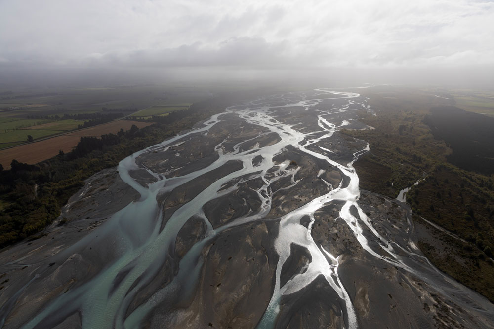
The Waimakariri River spans 90 miles across the South Island of New Zealand — from the Southern Alps to the Pacific Ocean — and is the main field site for Tamlin Pavelsky and his team.
In April 2023, three Carolina researchers traveled to New Zealand to work on a first-of-its-kind NASA satellite project that will measure the planet’s entire water supply.
“Brace!”
Tamlin Pavelsky and Marissa Dudek plant their feet and grab onto support beams as their jetboat driver, Steve Terry, makes a hard, 90-degree turn upriver — and floors it. Glacial blue water launches into the wake as gravel from the riverbed grates against the bottom of the boat. When the channel widens, Terry slows to navigate the best path forward.
Composed of multiple streams that weave back and forth, the Waimakariri River (“Waimak,” for short) is a braided river. It stretches about 90 miles across the South Island of New Zealand, from the Southern Alps to the Pacific Ocean. And it’s a major field site for a new NASA project.
A collaboration between NASA and the French space agency CNES, the Surface Water and Ocean Topography (SWOT) satellite will produce the first global survey of Earth’s surface water with unprecedented accuracy. Pavelsky — a professor of earth, marine and environmental sciences at UNC-Chapel Hill — is the freshwater science lead on the team.
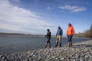
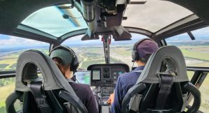
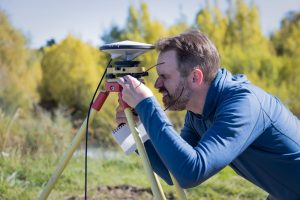
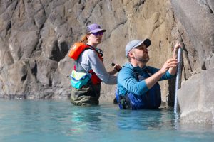
In April, Pavelsky spent six weeks in New Zealand with Dudek, a Carolina Ph.D. student, and research specialist Camryn Kluetmeier to verify the satellite’s data. To do so, they traveled up and down the river in boats and helicopters, using a GPS system to measure the elevation and a remote sensing device called LiDAR to create a high-resolution map of the landscape. They also installed water-level loggers to monitor changes in water height over time.
The data SWOT collects can inform how floodplains and wetlands change over time and the coastal processes related to fisheries, ship navigation, shoreline erosion and pollutants. More simply, it will track changes in water movement and volume across the planet — critical information for areas hit hard by drought or flooding — and will improve how we manage our water resources.
“This is a game-changer for our ability to understand how much water is flowing through rivers, how much water is stored in lakes and reservoirs and how ocean circulation works,” Pavelsky said.
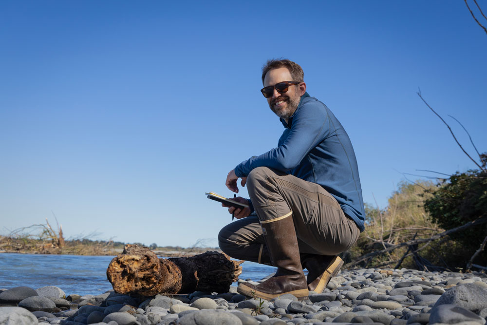
The natural-born hydrologist
Tamlin Pavelsky, professor
Studying glacial rivers makes Pavelsky feel at home. The hydrologist grew up in the backcountry of Alaska in the 1980s, hiking alongside pristine waterways like the Sanctuary and Teklanika with his dad.
“The water there is just this beautiful blue mass rushing out of the mountains to the south,” Pavelsky described. “As the two rivers merged, one clear and the other turbid, I wondered why they looked the way they do.”
Pavelsky began working on the SWOT mission in 2004 as part of a NASA fellowship when he was a Ph.D. student at the University of California, Los Angeles. He joined the Carolina faculty in 2009 and became the freshwater science lead on the project in 2013.
His expertise in remote sensing — using sensors on aircraft or satellites to gather data over water and land — and his experience working on complex rivers in the Arctic and Subarctic regions of the planet make him an ideal leader for this project.
After nearly 20 years of waiting to see what SWOT can do, Pavelsky feels like a kid in a candy shop.
“SWOT is like a piñata we’ve wacked with a baseball bat and now all this candy is pouring out,” he said. “There are so many things we want to understand about Earth’s water that SWOT is going to enable — and scientists will be grabbing that candy for the next five years to figure out what it all means.”
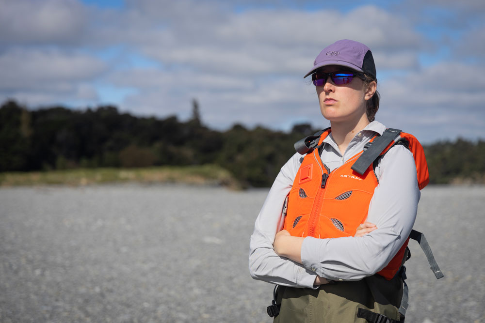
The Swiss army knife
Camryn Kluetmeier, research specialist
At 24, Wisconsin native Kluetmeier has already conducted research across the globe — from Woods Hole Oceanographic Institution in Massachusetts to the icefields of Alaska.
“I’ve been drawn to water my entire life, from just mucking around in lakes and streams as a kid,” she shared.
When she was 11, she became a volunteer stream monitor through a program with the University of Wisconsin-Madison. She’d visit the same stream each month to measure clarity and discharge.
She participated in the program for eight years before heading to Middlebury College, where she majored in environmental studies and geology. During her junior year, she studied abroad at the University of Canterbury in Christchurch, New Zealand — and when the borders began to close at the onset of the pandemic in spring 2020, she decided to stay put.
She spent the next year and a half attending classes at the university and exploring the island. That experience, alongside the numerous research studies she had worked on, made her the perfect candidate for the SWOT research specialist position.
Now, Kluetmeier is Pavelsky’s right hand for SWOT. She purchases gear and supplies, coordinates field days and to-do lists and is often the first to don a pair of waders and hop into the river when something goes wrong and needs to be fixed. On top of spending three months in New Zealand, she oversaw the bulk of data collection at the Alaska and California field sites last summer. In total, she spent nearly six months traveling for the project.
“The fact that we’re able to see global water around the world is absolutely mind-boggling to me,” she said. “We’re getting data from remote places we’ve never been able to gauge or see before and across international boundaries in different countries.”
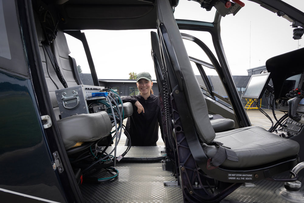
The co-pilot
Marissa Dudek, Ph.D. student
In 2020, Dudek spent six months working on projects at NASA’s Jet Propulsion Laboratory, using satellite data to monitor groundwater resources in California and the effect of permafrost thaw on infrastructure in Alaska.
That fall, she came to Carolina to pursue her master’s studies on the asteroids and meteors that impacted Earth, Venus and Mars across geological history. She’d heard Pavelsky was an expert in remote sensing, something she needed to learn more about for her research. In the process, she learned about the SWOT mission in New Zealand. Now a year into a UNC Ph.D. in geological sciences, she’s interested in studying the amount of water moving through the Waimak.
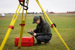
Dudek has a knack for modeling, writing code and analyzing data — and flying in helicopters for hours on end. She took the lead on most of the project’s helicopter data collection, where a LiDAR was attached to the front of a helicopter to generate a high-resolution map of the landscape. Such work is tedious and involves about seven hours of flight time in one day, which can cause dehydration and nausea.
For Dudek, motion sickness is well worth the data — and the views.
“The LiDAR collection is the most exciting part of the project,” she said. “It’s going to be able to tell us the water surface elevation of the entire channel. Plus, seeing the Waimak from a helicopter is amazing.”
Read an expanded story on the research and watch a video.
Stories, photos and video by Alyssa LaFaro
Published in the Fall 2023 issue | Features
Read More

Borders and boundaries
Political geographer Banu Gökarıksel directs Carolina’s popular curriculum in global…

Carolina to California
In the “Silicon Revolution” Maymester course, undergraduate students with a passion for…