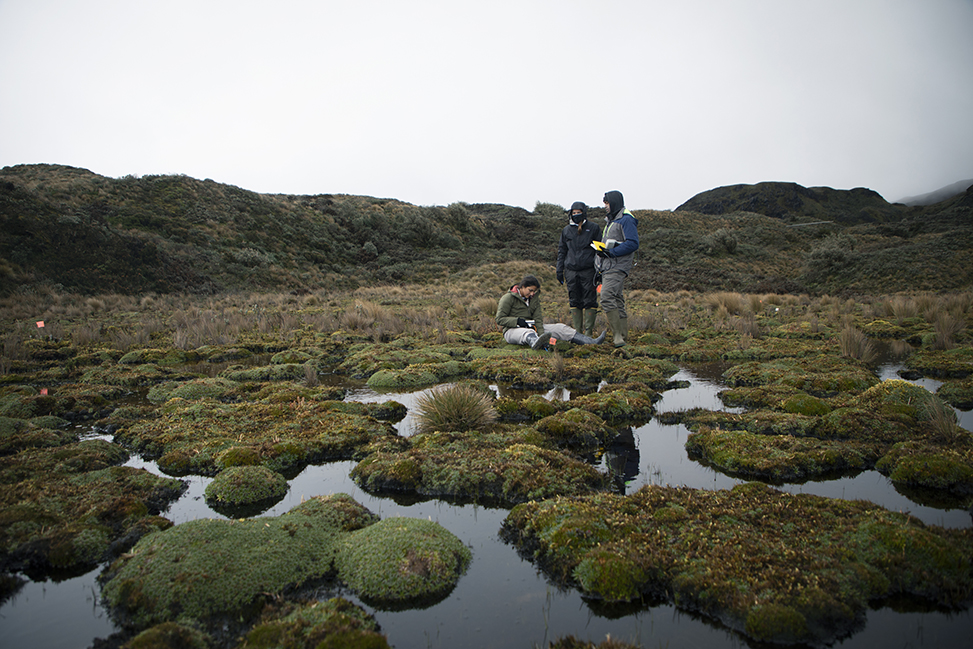
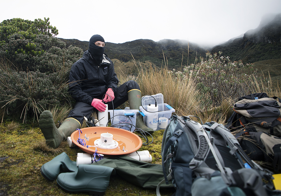
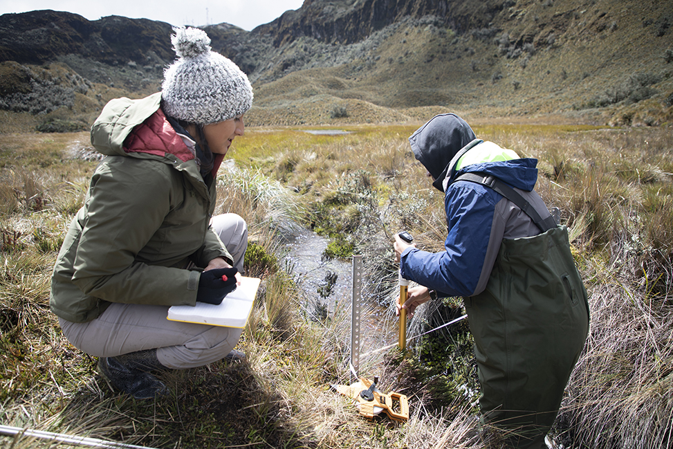
From left, Maribel Herrera, Chloe Schneider and Nehemiah Stewart drop a sensor into the small pools of these peatlands, located at the Cayambe Coca Ecological Reserve in Ecuador’s northern Andes Mountains, to measure carbon. As part of UNC geographer Diego Riveros-Iregui’s NSF Early Career Award project, these undergrads — along with two more and a PhD student — spent seven weeks studying this environment to learn how carbon travels through a watershed.
For thousands of years, the northern Andes Mountains have acted as a carbon sink, preserving organic matter as thick soil. As the planet warms, what will happen to all that carbon? This past summer, Carolina undergraduates traveled to Ecuador to take a closer look.
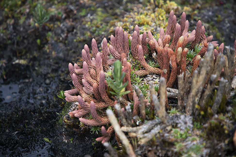
Moss-covered molehills pepper the landscape, each a different shade of autumn. Some are mustard yellow, others evergreen. Upon closer inspection, petite red buds can be seen peeping through the growth while spindly, fingerlike plants called lycophytes grow long and tall on the mounds’ surface. It’s as if a coral reef was scooped up from the ocean and plopped 14,000 feet on top of a mountain.
Students leap from one mossy hump to another, occasionally overshooting their mark and slipping into the muddy waters in between. As the students stop to catch their breath, they drop a sensor into one of the pools to measure carbon. Between measurements, they look up to admire the dusty white peaks of Antisana, the fourth-highest volcano in Ecuador. Just behind it sits Cotopaxi, once thought to be the highest summit in the world and now one of South America’s most active volcanoes, having erupted more than 50 times since 1738.
Home to 27 volcanoes, Ecuador has accumulated organic matter for thousands of years, as volcanic soils accumulate more carbon than any other ecosystem. Called a páramo, this type of landscape is found in the northern Andes. It’s a tropical environment, but because of the high elevation, the temperature remains low and the decomposition of organic matter slows. Scientists call locations like this carbon sinks — places of long-term carbon storage.
“The carbon content per unit area of soil is among the highest on the planet in this area,” says Diego Riveros-Iregui, associate professor of geography in the College of Arts & Sciences. “While these high-elevation mountains occupy only a very small area of the Andes Mountains, they are carbon-rich.”
In the last three centuries, both natural and human-made carbon dioxide emissions have contributed more to climate change than any other greenhouse gas. As the planet continues to warm, carbon decomposition rates within the North Andean páramo will increase and release all that organic matter into the atmosphere, further heating the planet.
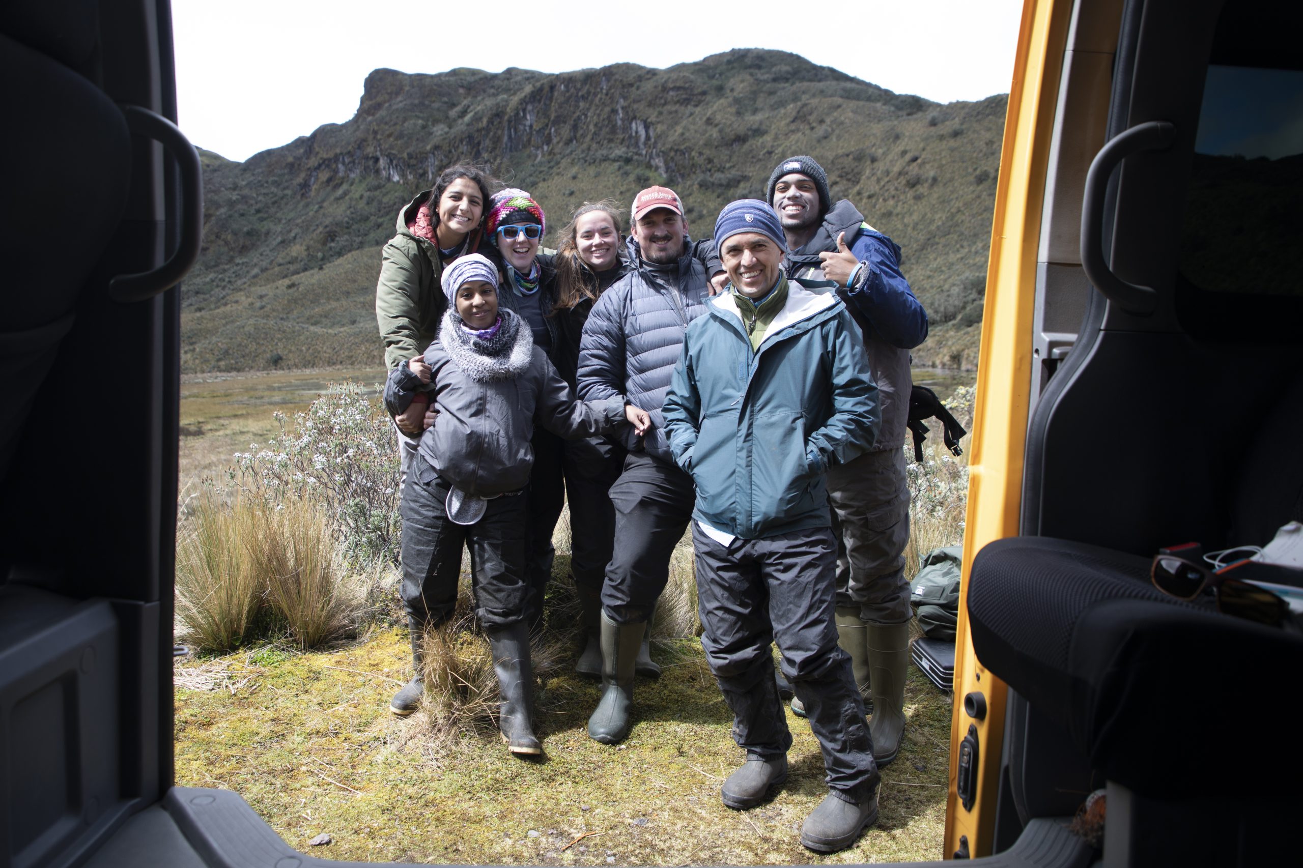
Riveros-Iregui is using his 2019 National Science Foundation Early Career Award, a five-year grant that combines research and education, to better understand these processes. He spent six weeks in Chapel Hill training five undergraduates and a Ph.D. student on carbon measurement methods within water systems. This past summer, the team spent two months in Ecuador measuring the carbon in a watershed at Cayambe Coca Ecological Reserve. This is the first of three cohorts he will take to South America.
Inland waters like those found in the North Andean páramo are very important in the carbon cycle because they emit greenhouse gases like carbon dioxide and methane at different times of the year, depending on how much water is flowing downhill.
“Given the elevation and mean annual temperature of these tropical environments, these would be sources of atmospheric carbon that are currently unaccounted for,” Riveros-Iregui explains.
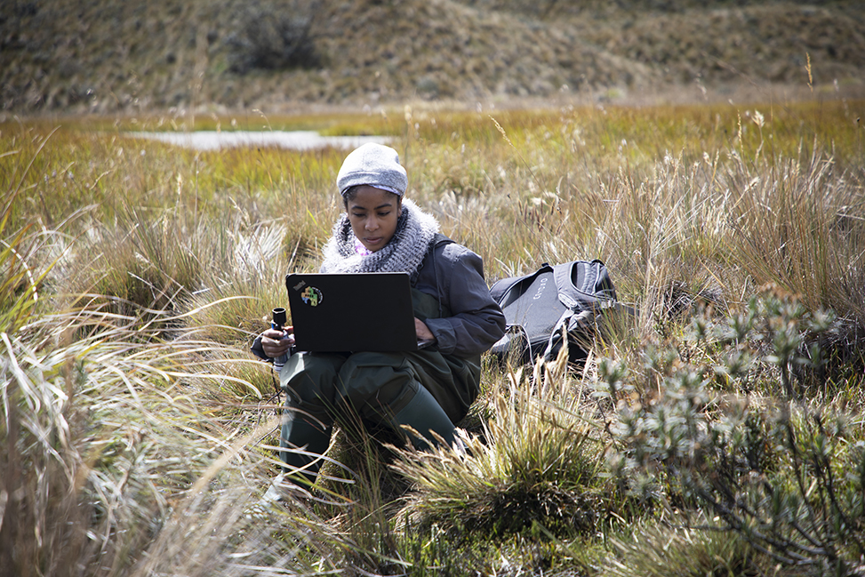
These tropical watersheds have never undergone consistent monitoring for this long, and the students involved have never conducted fieldwork — a challenge that entices Riveros-Iregui.
Data deluge
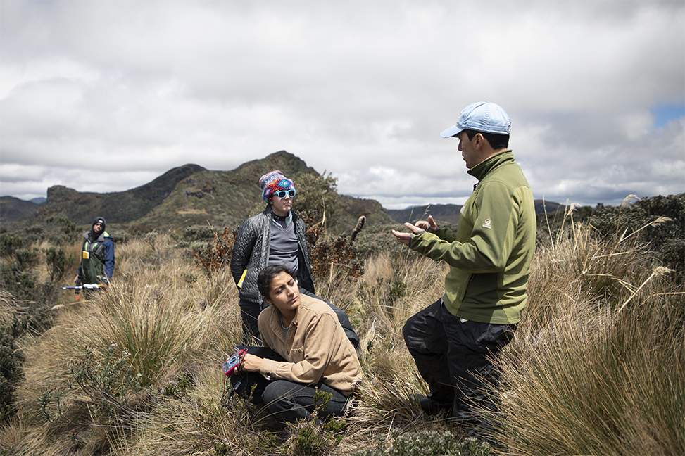
Knit hats. Face masks. Waterproof gloves. Winter jackets. Rainboots on top of three layers of socks. This is the reality of conducting research at the reserve, located just west of the continental divide. Some days it’s 50 degrees Fahrenheit and sunny; others, it’s 25 and sleeting.
When humidity generated hundreds of miles away in the Amazon crashes into the Andes Mountains, it undergoes orographic lifting, which is when air is forced from lower to higher elevation, causing it to cool quickly and form precipitation.
Today, a white mist settles over the mountain. It’s 36 degrees. The wind moves at about 10 mph. Visibility is 30 feet. Just 15 minutes away, toward town, the sky is blue and the sun is shining. But here, it’s like being trapped in a snow globe.
Senior Chloe Schneider, an environmental science and geography major, heads down a steep wooded hill, grabbing handfuls of long grasses and shrubs to stay upright. She carries a homemade carbon dioxide monitoring station — a gray plastic box attached to two pieces of wood and containing a battery-powered datalogger. Senior Megan Raisle follows, wielding a piece of rebar that will secure it to the ground.
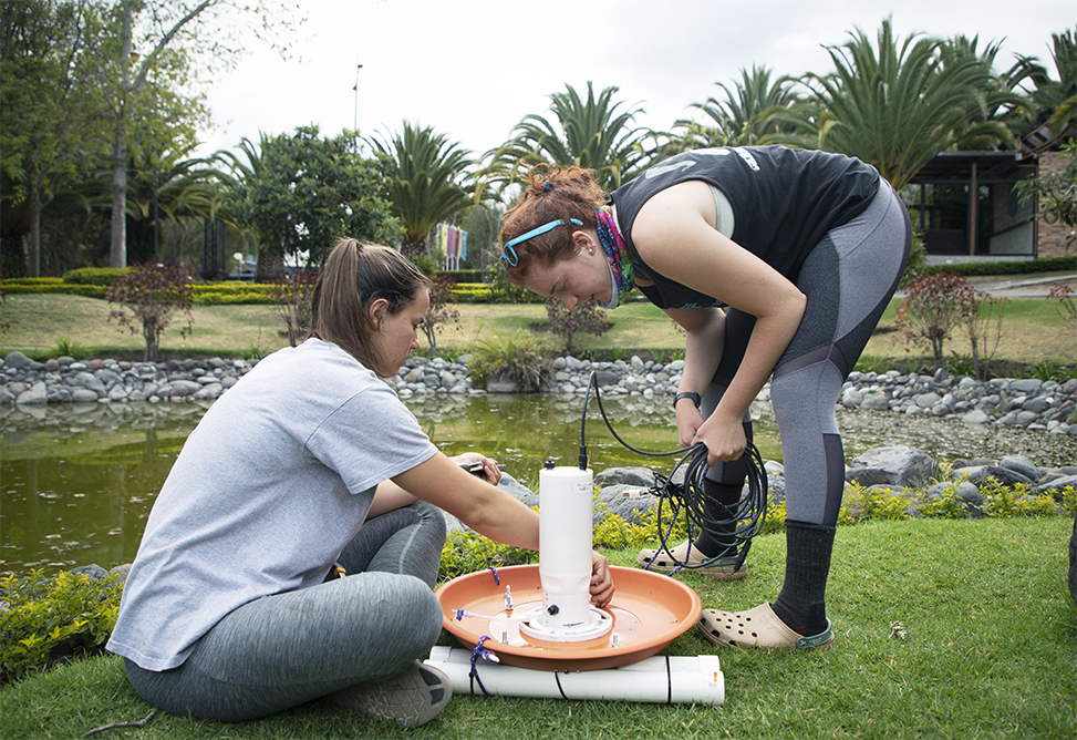
After making their way to the slope’s bottom, they secure the monitoring station, running a wire from the box to a sensor placed inside a PVC pipe embedded in the streambed. Later in the day, Schneider and Raisle, an environmental studies and geography major, repeat this trek, a different instrument in tow. On top of measuring the CO2 present in the water, they also need to record what’s being emitted into the air. To do this, they’ve created floating sensors using large flowerpot saucers, with plumbing components wedged into the centers to hold the air collection chamber firmly in place.
“Building the sensor housings and platforms feels like an exercise in critical thinking,” says geography Ph.D. student Andrew Murray, who designed the first iteration of these devices.
Additional sensors — 18 in all — measure water flow, dissolved oxygen, solutes like chlorophyll, other forms of carbon and salt. During the entire two-month expedition, they remained in place, collectively recording nearly 2,000 environmental observations a day.
“These measurements allow us to paint a broad picture of what happens to the carbon stored in these ecosystems every time it rains,” Riveros-Iregui says.
Senior Maribel Herrera is well-versed in geography and environmental studies, her two majors, but she’s just beginning to learn the analysis aspect. “I’m comfortable with deploying the sensors,” she says. “But then when I get the data, I’m like, ‘Okay, how do I synthesize this and what do these numbers mean?’”
Cue Murray. Not only did he create the blueprints for the sensor stations and oversee the project’s execution in Ecuador, but he also specializes in R — a high-level computer programming language for data management analysis — and he guided the students in that work.
“Collecting good data is just one piece of the puzzle,” Murray says. “Knowing what to do with it and being able to work on it collaboratively with other people is essential to being a successful researcher.”
Path to the páramos
Riveros-Iregui grew up in Fusagasugá, Colombia, which sits about 10 miles from the Sumapaz páramo. While these environments have long fascinated him, he didn’t begin studying them until the past decade.
After finishing an undergraduate geoscience degree in Colombia in 2001, he traveled to the United States with the plan to enroll in graduate school. But he discovered that his English was insufficient, the cost more than expected and the U.S. education system confusing.
A neighbor suggested enrolling in a community college, even though he already had a four-year degree from a Colombian university. “It sounded like a good idea,” Riveros-Iregui says, laughing. “And I did not have a plan B.” After earning an associate’s degree in computer science, he was offered a teaching assistantship at the University of Minnesota, where he completed his master’s in geology.
Stumbling over the graduate school process is far from unique, he says. “I come across so many students who want to go to graduate school, but don’t know how to go about it. With the right guidance and gaining some exposure to research during their undergraduate [career], students can become competitive for graduate school fellowships.”
Mentors and friends
For junior Anayancy Estacio-Manning, a global studies major, just being out in the field is unfamiliar, let alone being in an extreme environment.
Despite spending more than a month in Chapel Hill prepping for the international fieldwork, Estacio-Manning felt lost at first. The other students, three of whom are studying geography and environmental science, would often discuss things like pH and dissolved oxygen levels with ease as they practiced setting up experiments. “I’d go back home and look up whatever it was they were talking about,” she said.
But Riveros-Iregui encouraged her abilities, and now that she’s back in Chapel Hill, Estacio-Manning recognizes how far she’s come and has grown more confident. “Knowing the two, physical science and social science, makes me sort of bilingual. And so now I can be that translator.”
This fall, Estacio-Manning and the four other students will use these new skills at the Museum of Life and Science in Durham, where they will present on the work they performed in Ecuador to North Carolina families.
Riveros-Iregui places special emphasis on teaching and mentorship, noting that he had few mentors during his college career. He navigated academia alone — a feat that draws him to students like Estacio-Manning, one of three first-generation students working on this project.
“I want them to know that if I could do it, so can they,” Riveros-Iregui says.
Beyond the field experience, the five students agree that one of the biggest benefits has been getting to know one another.
“No one can take [away] this bond we have,” says junior Nehemiah Stewart, who is majoring in chemistry. “What we’ve formed here is something crazy. What we’ve formed is lifelong friendships.”
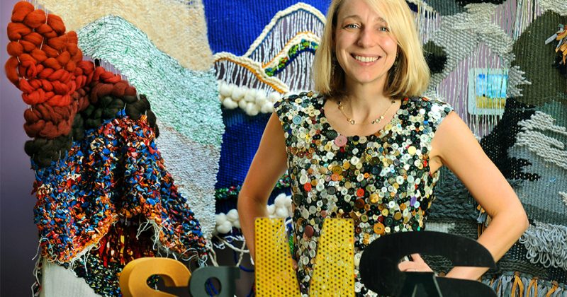
Story and photos by Alyssa LaFaro, editor of Endeavors magazine. Watch a video.
Published in the Fall 2019 issue | Features
Read More
Mellon funding supports environmental humanities
The Andrew W. Mellon Foundation has awarded a $150,000 two-year…
Two major awards for computer science faculty
Computer scientists Ron Alterovitz and Mohit Bansal have won prestigious…